Image
The on-line database with geochemical maps of selected areas in Lower Silesia
Published on 24 May 2018

Poland
Dolnośląskie
This is the good practice's implementation level. It can be national, regional or local.
About this good practice
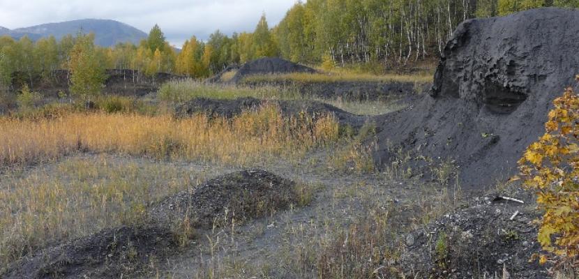
Lower Silesia is famous for its centuries-old mining traditions but there is a lack of monitoring and data on the places of historical extraction and processing of raw materials.
The database, publicly available on-line via the goportal of Polish Geological Institute - National Research Institute (PIG-PIB), provides information on mineral waste materials collected on old heaps, industrial storage sites and in postmining settling tanks - 450 facilities related to the mining processing of hard coal and metal ores (incl. radioactive uranium) as large facilities of millions of cubic meters capacity and small inactive heaps.
The geochemical maps provide spatial information about sites as: lithological and chemical characteristics of the waste, geoenvironmental data, formal and legal status, information about the surroundings: roads, technical infrastructure, land development, protected areas, geohazards, etc. They illustrate the way in which the elements considered to be environmentally toxic are spread with rainwater and get into cultivated soils, waters and then into plant's and animal's organisms. It’s interesting from a scientific point of view but also due to economic and environmental aspects.
The study is a good practice due to its comprehensive approach to former mining residual waste, incl. identification of potential environmental hazards and exploit the potential for the waste reuse or neutralization of environmentally harmful objects.
Resources needed
The cost of work on the project "Mineral waste resources on heaps of former mining and the processing of minerals of the Sudetes - a database with geochemical maps of selected regions in the scale of 1:10 000" amounted to approximately PLN 1 018 800 (ca. EUR 250,000).
Evidence of success
The data was collected for 450 facilities of anthropogenic origin (heaps, industrial storage sites, post-mining settling tanks) which until now have not been so widely analyzed. An information sheet has been developed for each of the facilities, with over 100 detailed items, including lithological and chemical characteristics of waste, geoenvironmental data, the formal and legal status, information on technical infrastructure, land development, protected areas, geohazards.
Potential for learning or transfer
The database is the source of knowledge for: public administration, mining enterprises, organizations dealing with environmental monitoring and protection. Public authorities often do not recognize hazards resulting from the old heaps and have no idea how to adopt or liquidate them . It is a reference source in land use planning, e.g. new infrastructure which helps to indicate potential problems, incl. the issue of surface water pollution, and avoid environmental risks.
The on-line databas with easily available public information has a real potential to follow by other regions, struggling with similar problems (residues of closed mines and raw materials processing). It can be a source of inspiration for carrying out a similar study providing systematic geo-environmental monitoring. The abandoned heaps can be potential sources of raw materials as old processing techniques were less efficient and the mineral wastes can meet the criteria for cost-effective deposits.
The on-line databas with easily available public information has a real potential to follow by other regions, struggling with similar problems (residues of closed mines and raw materials processing). It can be a source of inspiration for carrying out a similar study providing systematic geo-environmental monitoring. The abandoned heaps can be potential sources of raw materials as old processing techniques were less efficient and the mineral wastes can meet the criteria for cost-effective deposits.
Further information
Website
Good practice owner
Organisation
Polish Geological Institute - National Research Institute (PIG-BIP)
Poland
Dolnośląskie
Contact
Chief specialist