SATSDIFACTION organises its 5th Learning Deep Dive in Liege

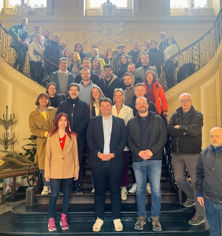
From 7 to 10 April 2025, the Wallonia Region successfully hosted the fifth Learning Deep Dive (LDD) of the SATSDIFACTION project in the city of Liège, Belgium. Organised at the Silversquare Guillemins venue, the initiative brought together regional authorities, project partners, and thematic experts to discuss innovative approaches to flood risk management and explore how Earth Observation (EO) technologies can reinforce resilience at the local and regional levels.
The event was formally opened with welcoming remarks by high-level representatives from the Walloon government and public institutions, demonstrating strong political commitment to the themes addressed by the project. Among them were Pascal Engleblert, representing the Minister of Infrastructures and Territories; Yannick Paulet, representing the Minister of Agriculture and Rural Affairs; Rose Detaille, General Manager of ISSeP; Bénédicte Heindrichs, General Manager of SPW ARNE; and Chloé Beaufays, representing the Mayor of Liège. On behalf of NEREUS, Secretary-General Roya Ayazi emphasized the value of interregional collaboration as a foundational principle of the network and a critical element of the SATSDIFACTION project’s long-term sustainability. Project Coordinator Mirko Mazzarolo from the Veneto Region presented key achievements to date and outlined forthcoming milestones.
The first day of the programme included a powerful thematic session on the devastating floods that impacted Wallonia in 2021, illustrating the critical role of geospatial data and satellite applications in emergency response and crisis coordination. Participants reflected on the lessons learned and the importance of robust regional mechanisms for managing extreme weather events.
On 8 April, the Learning Deep Dive focused on flood risk management, policy integration, and cross-border cooperation. Patrick Engels (SPW ARNE) presented remote sensing coordination, while Christophe Dessers (University of Liège) showcased hydrological modelling in the Vesdre catchment. Benjamin Palmaerts (ISSeP) and Daniela Rodriguez Castro (University of Liège) introduced EO-based flood tools, and Colin Glesner (SPW CORTEX) highlighted the Interreg MARHETAK project. In the afternoon, Adrien Michez discussed EO data integration in policymaking, followed by a lively exchange among SATSDIFACTION partners on regional practices and geodata use.
The third day, held on 9 April, was dedicated to a field visit throughout the Vesdre catchment area, offering participants the opportunity to observe tangible examples of flood prevention, river restoration, and climate adaptation in practice. In Pepinster, Sébastien Gailliez (SPW ARNE) guided participants through sites where re-meandering and riverbank restoration projects have been implemented. A special moment of the visit was the meeting with Maxime Degey, Mayor of Verviers, who discussed the municipality’s experience managing the 2021 floods and the strategic role of satellite data in supporting local action. The mayor also publicly promoted the initiative through his social media channels.
Further stops included a visit to the Gileppe dam, where Christophe Grifgnée and Vincent Lognay (SPW MI) explained dam operation strategies during flood events, and the Mont-Rigi Scientific Station, where Josip Brajkovic (University of Liège) presented future projections of extreme rainfall scenarios. In the High Fens, Philippe Frankard and Yves Pieper (SPW ARNE) introduced ongoing peat bog restoration initiatives designed to improve natural water retention and ecosystem resilience.
The Learning Deep Dive concluded on 10 April with a mid-term review and project reflection day. The session included a presentation by NEREUS on the integration of satellite data into regional ecosystems, followed by a summary of key takeaways from the mid-term review meeting with the Joint Secretariat. Regione Veneto, as lead partner, presented reflections on the evaluation outcomes and next steps, while Silvano De Zorzi (IEST) reported on the results of the partner survey. The session also addressed monitoring approaches for policy improvements and guidance on the financial closure of the project’s core phase. The afternoon allowed time for bilateral exchanges among partners, reinforcing collaboration as the project advances toward its next implementation stage.
The 5th SATSDIFACTION Learning Deep Dive in Wallonia served as a pivotal opportunity for knowledge transfer, experience sharing, and interregional collaboration. It showcased how satellite data and geospatial applications are central to building regional resilience and enhancing disaster preparedness in the face of climate-related risks.
